

Where is the Oil Spill?

Here's another map courtesy of Wired (the spill site is between the two sets of red hash marks):

Here's an image of the Gulf of Mexico, showing the Sigsbee and Florida Escarpments (Block 252 is approximately half way in between the 2 escarpments):

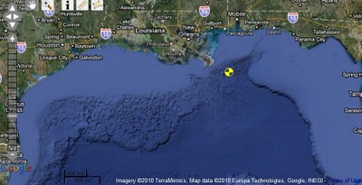
Here is a satellite image of the area provided by the Minerals Management Service and NOAA's Multipurpose Marine Cadastre:
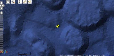
Here is a close-up (I placed a hand icon at the approximate location of the oil spill based on latitude and longitude):
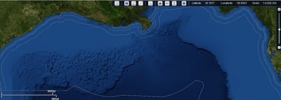
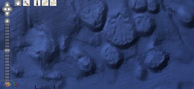
Here is an image - courtesy of NOAA's GeoPlatform service - showing the topography surrounding the leaking wellhead:
Here is a close up of the same image:
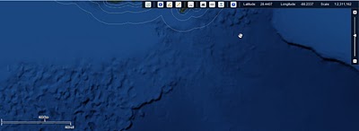
Here is the same image with the spill location indicator removed, so that you can see the slope of the area at the spill site:
It's the largest environmental disaster in U.S. - and possibly world history.
But do you know exactly where it is? Could you point to a map and show where the oil rig sank?
Do you know what the topography of the surrounding area is?
Hint: If you think it's flat seafloor - as implied by BPs drawings - you'd be wrong (the spill site is actually located within a giant canyon system, rather than on flat ground).
This essay will provide some basic orientation as to ground zero for the oil spill.
Where Is the Spill Site?
Here is the spill site - designated with the fire icon - as shown on Google maps:

This NOAA image gives a basic overview of the oil spill site in relation to the surrounding area:
The oil spill is occurring within the "Macondo prospect", which is located in Mississippi Canyon Block 252 in the Gulf of Mexico.
Hint: If you think it's flat seafloor - as implied by BPs drawings - you'd be wrong (the spill site is actually located within a giant canyon system, rather than on flat ground).
This essay will provide some basic orientation as to ground zero for the oil spill.
Where Is the Spill Site?
Here is the spill site - designated with the fire icon - as shown on Google maps:
This NOAA image gives a basic overview of the oil spill site in relation to the surrounding area:
The oil spill is occurring within the "Macondo prospect", which is located in Mississippi Canyon Block 252 in the Gulf of Mexico.
Here is an image showing the Mississippi Canyon compared to other areas in the Gulf of Mexico:

This shows the relation of Block 252 to nearby sites:

Here is Block 252 shown in comparison with nearby sites:

And this is the definitive high-resolution map showing block 252 in comparison with other prospects in the Mississippi Canyon area and surrounding areas.
This shows the relation of Block 252 to nearby sites:
Here is Block 252 shown in comparison with nearby sites:
And this is the definitive high-resolution map showing block 252 in comparison with other prospects in the Mississippi Canyon area and surrounding areas.
But in order to really get a feel for what's happening underwater, we should look at detailed topographic maps. Indeed, knowing the topography and the geology at the spill site is crucial in understanding the risks involved and being able to determine the best approach for stopping the leak.
Topography of the Spill Site
Here's a map of the Gulf of Mexico:
Here's another map courtesy of Wired (the spill site is between the two sets of red hash marks):
Here's an image of the Gulf of Mexico, showing the Sigsbee and Florida Escarpments (Block 252 is approximately half way in between the 2 escarpments):
Here is a satellite image of the area provided by the Minerals Management Service and NOAA's Multipurpose Marine Cadastre:
Here is a close-up (I placed a hand icon at the approximate location of the oil spill based on latitude and longitude):
Here is an image - courtesy of NOAA's GeoPlatform service - showing the topography surrounding the leaking wellhead:
Here is a close up of the same image:
Here is the same image with the spill location indicator removed, so that you can see the slope of the area at the spill site:
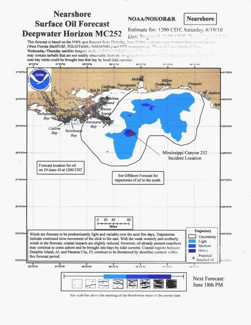
(Note: the GeoPlatform service is also very useful for forecasting the near-term trajectory of the oil spill).
Here is a map giving a different view of the steep canyon in which the oil spill site is located:

Some oil industry professionals are worried that a landslide at the spill site could make the oil spill much worse by carrying away the blowout preventer, riser and all other equipment. While I have no idea how likely it is that a landslide could occur before the well is capped, it is true that:
Some oil industry professionals are worried that a landslide at the spill site could make the oil spill much worse by carrying away the blowout preventer, riser and all other equipment. While I have no idea how likely it is that a landslide could occur before the well is capped, it is true that:
(1) The spill site is located in a steep canyon, as discussed above;
(2) There are hundreds of feet of loose mud and muck on top of the sea floor in this area; and
(3) Many deepwater, oil-rich areas within the Gulf are tectonically active.
No comments:
Post a Comment